Share
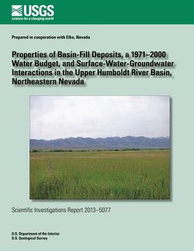
Properties of Basin-Fill Deposits, a 1971?2000 Water Budget, and Surface- Water-Groundwater Interactions in the Upper Humboldt River Basin, Northeaste (in English)
J. Larue Smith
(Author)
·
Russell W. Plume
(Author)
·
Createspace Independent Publishing Platform
· Paperback
Properties of Basin-Fill Deposits, a 1971?2000 Water Budget, and Surface- Water-Groundwater Interactions in the Upper Humboldt River Basin, Northeaste (in English) - Smith, J. Larue ; Plume, Russell W.
$ 14.39
$ 17.99
You save: $ 3.60
Choose the list to add your product or create one New List
✓ Product added successfully to the Wishlist.
Go to My WishlistsIt will be shipped from our warehouse between
Tuesday, June 04 and
Wednesday, June 05.
You will receive it anywhere in United States between 1 and 3 business days after shipment.
Synopsis "Properties of Basin-Fill Deposits, a 1971?2000 Water Budget, and Surface- Water-Groundwater Interactions in the Upper Humboldt River Basin, Northeaste (in English)"
This study was done in cooperation with Elko County, Nevada in response to concerns over growing demand for water within the county and increasing external demands that are occurring statewide. The upper Humboldt River basin encompasses 4,360 square miles in northeastern Nevada and includes the headwaters area of the Humboldt River. Nearly all of the mean annual flow of the Humboldt River originates in this area. Basin-fill deposits function as the principal aquifers in the upper Humboldt River basin. Over much of the basin lowlands, the upper 200 feet of basin fill consists of clay, silt, sand, and gravel deposited in a lake of middle to late Pliocene age. Fine-grained lacustrine sediments compose from 30 to more than 70 percent of the deposits. Mean values of transmissivity are less than 1,000 feet squared per day. Total inflow to the upper Humboldt River basin, about 3,330,000 acre-feet per year, is entirely from annual precipitation. Total outflow from the basin, about 3,330,000 acre-feet per year, occurs as evapotranspiration, streamflow, subsurface flow, and pumpage. The uncertainty of these values of inflow and outflow is estimated to be 25 percent. Baseflow of the Humboldt River is minimal upstream of the Elko Hills and in downstream reaches almost all baseflow comes from tributary inflow of the North Fork and South Fork Humboldt Rivers. However, the baseflow of these two tributaries comes from groundwater discharge to their respective channels in canyons incised in volcanic rocks along the North Fork and in carbonate rocks along the South Fork. Water levels in the shallow water-table aquifer along the Humboldt River flood plain fluctuate with changes in stage of the river. During high rising river stage in spring and early summer, streamflow enters the aquifer as bank storage. As stage begins to decline in early to mid-summer groundwater in bank storage begins discharging back into the river channel and this continues through late summer. In years of below average flow some reaches of the river are dry in late summer. Flood plain deposits are more permeable than adjacent and underlying fine-grained sediments of the Pliocene lake and the two aquifers are poorly connected.

